Weather Windows: Interpreting Forecasts for a Safe Day Out
A “weather window” is the slice of time that turns a nice plan into a calm, uneventful day out. This guide shows how to read the UK Shipping Forecast, the Inshore Waters Forecast, and your favourite apps—then blend them into a simple, repeatable routine for go/no-go decisions. The goal isn’t perfect predictions; it’s good enough information to choose kinder wind, tide and visibility.
Know your sources (and what each is good for)
- Shipping Forecast (sea areas): the big picture for wind direction/range and systems moving through. Great for timing fronts and gradients, especially if you’re day-sailing near the boundary of two areas.
- Inshore Waters Forecast: the detail for 12 miles off the coast: wind, gusts, sea state and visibility for your stretch of water (e.g., Thames, Wight, Plymouth). This is your primary text forecast for a day sail.
- Apps/models: high-resolution wind/wave maps, gusts and rain radar. Use at least two different models so you see agreement vs disagreement. Treat pretty maps as guidance, not gospel.
A 10-minute weather window routine
- Scan the synoptic story: Is pressure rising or falling? Any fronts due? Expect gusts and wind shifts near frontal passages.
- Read your Inshore Waters area: Note direction, mean wind, gusts, sea state, visibility. Highlight the time words (e.g., “increasing later”, “veering by evening”).
- Check two apps/models: Compare wind and gust values through the day. Look for consistency in timing of any increase, veer/back, or showers. If they disagree by a force or more, assume the livelier outcome.
- Add tide: Identify any wind-against-tide periods on your route (bars, headlands, overfalls, narrow channels). If wind is fresh against a big ebb, expect steeper, wetter chop.
- Choose the window: Pick a departure/return that lines up kinder wind with helpful tide—and gives daylight buffer for the approach.
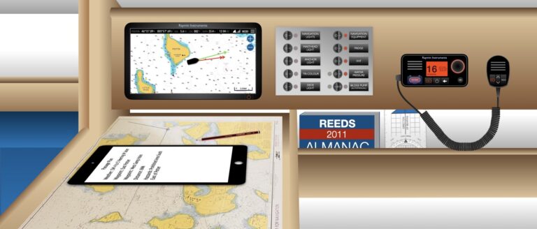
- Write a one-line brief: “NW 3–4 veering N 4 after 1600; ebb 1300–1600; return before wind-against-tide at 1700; visibility good.” Put it on the nav table.
What “good enough” looks like
- Two sources agree on wind strength/direction within about a Beaufort force and a quadrant.
- Gusts stay inside your comfort margin, and any increase happens after you plan to be home or in shelter.
- Tide and wind aren’t fighting in your critical legs (bar crossing, headland, harbour approach).
- Visibility is “good” for the approaches you’ve planned (or you’re comfortable in radar-assisted pilotage if it’s marginal).
Worked example (coastal day out)
Scenario: You plan a coastal hop, 18 nm out and back. Shipping Forecast suggests a ridge today with isolated showers; Inshore Waters says W 3–4, occasional 5 later, slight sea, visibility good, showers; your tide table shows a strong ebb mid-afternoon.
- You spot model agreement on W 12–15 kt until ~1500, gusts 18–22 kt, then a brief pulse W 18–22 kt, gusts 25 kt around 1700.
- You mark a late-morning departure with an early-afternoon return to avoid the stiffer breeze and the wind-against-tide chop later.
- Your one-line brief reads: “Out 1030, back 1430, W 3–4; avoid 1700 pulse; showers brief; visibility good.”
Could you still go later? Perhaps—but you’d plan a shorter route with more shelter and a generous bail-out.
Sea state: the bit many overlook
- Wave height & period: A modest wind can produce a tiring sea if fetch is long or tide opposes. Your app’s wave layer + local knowledge beats raw wind numbers.
- Headlands & overfalls: Even on calm days, check chart notes and guidebooks for “wind against tide = rough” warnings near capes and banks.
Nowcasting on the day
- Look up, not just down: Darker shower lines bring squalls and veers/backs; a tightening isobar pattern means wind lifting.
- Watch the water: Whitecaps building and a rising SOG downwind of headlands hint the breeze is edging up sooner than forecast.
- Re-plan early: Reef before you need to; swap “that far headland” for a friendlier destination if the window is closing.
Common mistakes (and quick fixes)
- Trusting one app: Always compare two models and the text forecasts.
- Ignoring gusts: Gusts, not means, usually drive your sail plan. Read both.
- Forgetting wind-against-tide: The number on the screen isn’t the whole ride. Time the bar/headland for slack or with the stream.
- Over-committing: Build bail-outs into your Passage Planning & Making so changing course feels normal, not like failure.
Downloads for your skipper pack
UK Inshore Waters Forecast
Shipping Forecast Sea Areas
Weather Forecast Capture Sheet
Build the habit (keep it boring—in the best way)
- Write a one-line weather plan on the nav table before every trip.
- Set a phone reminder to re-check the text forecast 2–3 hours before departure.
- Debrief what actually happened vs forecast; adjust your “good enough” rules next time.
Enrol when you’re ready
- Start Day Skipper Theory (online)
- Enrol in Essential Navigation & Seamanship (online)
- Join the free Sailing Essentials course
Related RYA courses (overview & providers)
Weather windows aren’t luck; they’re a habit. Read two forecasts, compare two models, line it up with the tide—and enjoy how easy your day out feels.


