


Height of Tide
The vertical distance of the sea surface above the chart datum at a stated place and time.
Adding predicted height of tide to a charted drying height or depth gives an estimate of water level or available depth, provided the same datum is used. Chart datum is often related to Lowest Astronomical Tide but its exact definition is stated on the chart and should not be assumed.
Predictions are estimates for standard locations and conditions. Atmospheric pressure, wind, river flow, waves and local timing differences can alter observed water level, so safety margins and actual observations are required where clearance is limited.
Do you know your Tidal Height terms?
Try our quick test tidal height terminology game. Match the tidal height terminology to the appropriate space on this cross-section diagram.
Use our handy crib sheets to work out you tide height conundrums
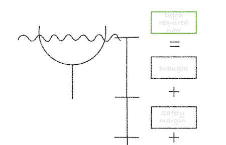
Height of tide needed to clear a charted depth
Height of tide needed to clear a drying height


