Dead Reckoning (DR)
A navigational method used to estimate a vessel’s current position based on a previously known position, factoring in speed, time, and course without using celestial or satellite navigation.
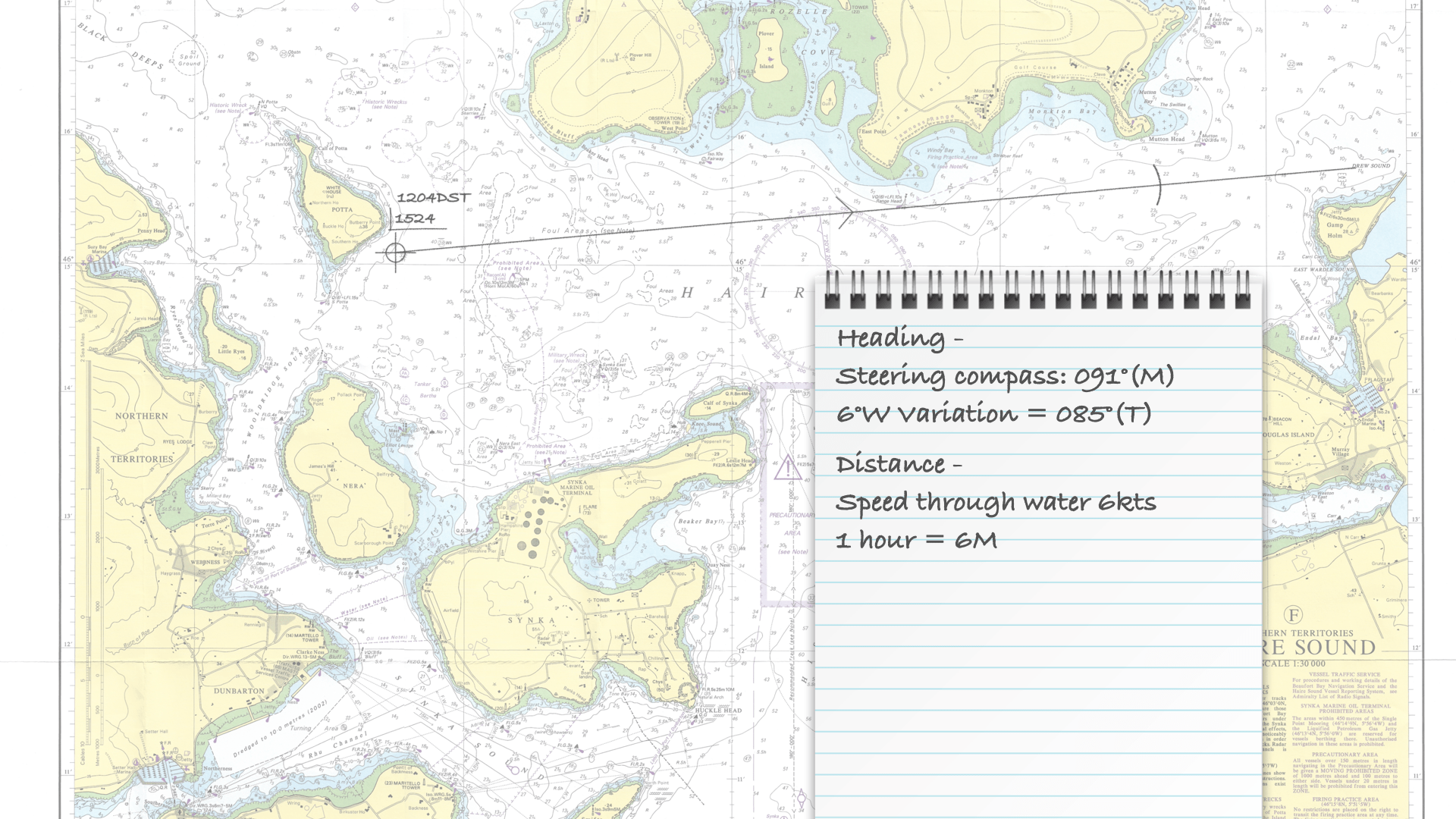
Dead reckoning is a fundamental technique in marine navigation that allows sailors to determine their position at sea when more advanced methods, such as GPS or celestial navigation, are unavailable or impractical. The process involves calculating the vessel’s current position by projecting its course and speed from a known starting point. This is typically done by using the ship’s compass to measure the direction (bearing) and the log to measure speed. The navigator then uses this information, along with the time travelled, to estimate the distance covered and plot the new position on a chart.
However, dead reckoning is inherently prone to errors, as it does not account for external factors such as wind, currents, or drift, which can cause the vessel to deviate from its intended course. Over time, these errors can accumulate, making the estimated position less accurate. Navigators often combine dead reckoning with other techniques, such as taking bearings on known landmarks or using soundings to confirm their position to mitigate this. Despite its limitations, dead reckoning remains valuable, especially when electronic navigation systems fail or are unreliable.
Traditional Chart Dead Reckoning on a chart verus a chart plotter
Traditionally, dead reckoning on a paper chart involved converting a magnetic bearing to a true bearing, then drawing a heading line from the vessel’s position. The navigator might also apply a leeway correction before drawing the line.
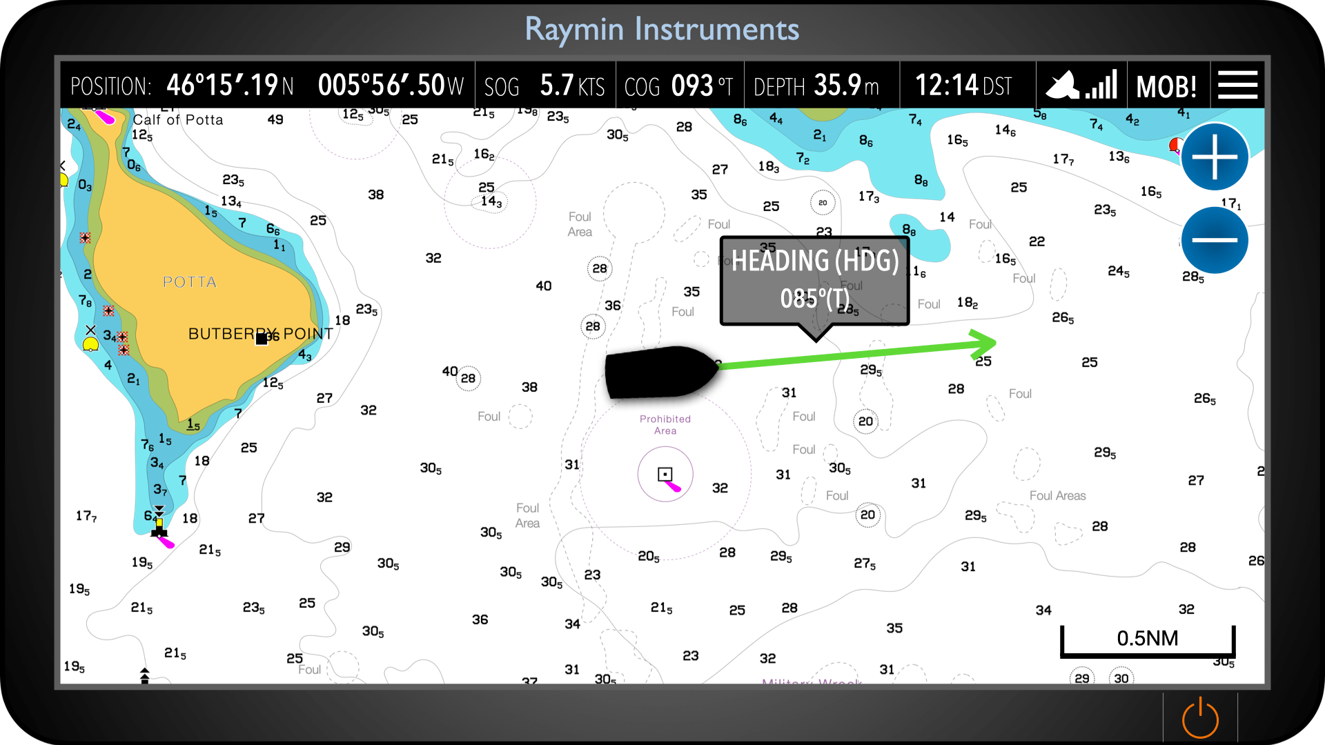
On modern chart plotters, the heading vector is displayed automatically from the vessel’s position. Its length represents a set time or distance ahead. This digital vector does not allow for leeway, as it is based solely on the vessel’s heading sensor rather than the vessel’s actual track through the water.