


Height of Light
The elevation of a navigational light’s focal plane above its stated vertical datum.
For a shore light, the chart or light list states both the height and the datum used; the datum varies by hydrographic authority and location and must not be assumed always to be Mean High Water Springs. The focal plane is the level from which the light is emitted, not necessarily the top of the structure.
Height of light is used with observer height to estimate geographic range, which can differ from luminous range governed by intensity and atmospheric visibility. Charted values and notes from the relevant current publication should be used.
Do you know your Tidal Height terms?
Try our quick test tidal height terminology game. Match the tidal height terminology to the appropriate space on this cross-section diagram.
Use our handy crib sheets to work out you tide height conundrums
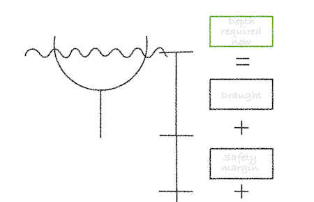
Height of tide needed to clear a charted depth
Height of tide needed to clear a drying height


