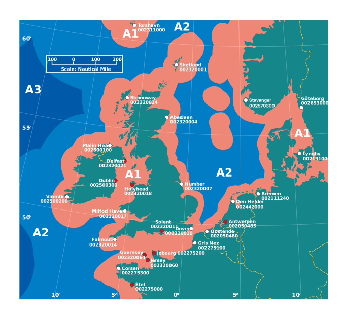
GMDSS Sea Areas
Four coverage-based areas—A1, A2, A3 and A4—used to determine GMDSS radiocommunication carriage and alerting arrangements.
A1 is within continuous VHF DSC coverage of a coast station; A2 extends beyond A1 within continuous MF DSC coverage; A3 lies beyond A1 and A2 within recognised mobile-satellite service coverage; A4 is the remaining area.
They are not a map of three UK coastal zones, and boundaries depend on declared coast-station and satellite coverage. A vessel’s required equipment follows its applicable regulations and intended sea area.
Sea area A1
Sea area A2
Sea area A3