All our courses are engaging, interactive and fun! Whether formal training or simply looking to brush up, we take online learning to the next level.
Buoy or pillar placed North, East, South or West side of an obstruction to warn vessels away. Cardinal marks indicate that the deepest water in the area lies to the named side of the mark. They are used in conjunction with the compass to indicate the direction from the mark in which the deepest navigable...
To let go a rope or line
A type of multihulled vessel featuring two parallel hulls of equal size, connected by a deck or framework, offering stability, speed, and efficiency in the water. A catamaran is a distinctive type of watercraft that stands out due to its twin-hull design. Unlike traditional monohull boats, which rely on a single hull for buoyancy and stability, a...
A vessel whose ability to deviate from its current course is significantly restricted due to the depth of water relative to its draught. A vessel "Constrained by Draught" refers to a specific situation under the International Regulations for Preventing Collisions at Sea (COLREGs), where a ship's manoeuvrability is severely limited because of the relationship between...
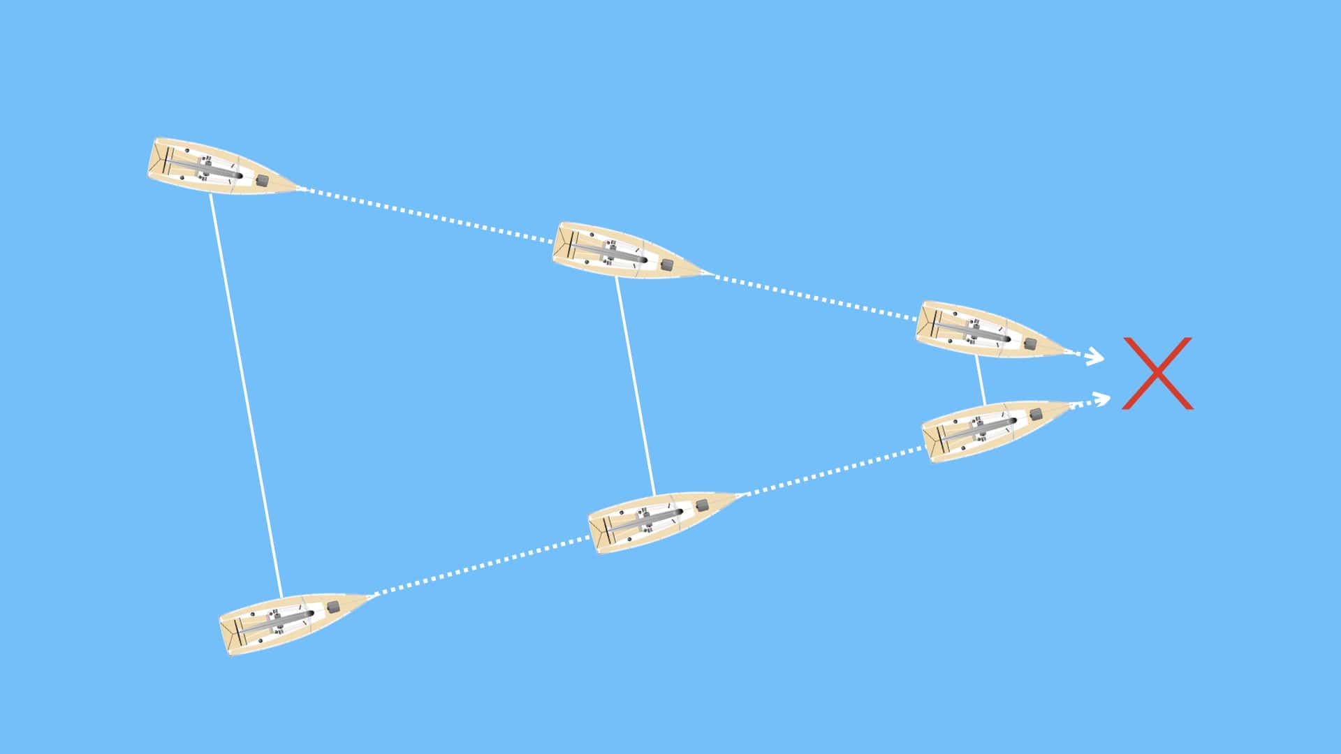
A navigational situation where two vessels maintain the same relative bearing to each other while the distance between them diminishes, often indicating a potential risk of collision. Constant bearing, decreasing range (CBDR) is a critical concept in maritime navigation, used to assess collision risks between vessels at sea. When two vessels are on a CBDR...
The International Maritime Signal Flag Charlie. Meaning Affirmative.If appended with a Numeral Pennant, a Magnetic Bearing.
The CEVNI Test Online is a certification required for those navigating inland waterways in Europe. The test covers the European Code for Inland Waterways (CEVNI), including navigation rules, signage, and operational requirements. This online exam ensures participants understand the specific regulations governing inland navigation, making it a vital qualification for those seeking the International Certificate...
Chafing is damage or wear caused by friction between two surfaces, such as ropes rubbing against a boat's railing or sails rubbing against a mast. If not addressed, chafing can weaken materials and lead to potential safety hazards. Protective coverings or guards can be used on vulnerable areas to prevent chafing to reduce friction and...
A strong metal plate, usually stainless steel, bolted to a boat’s hull or deck to which the shrouds or stays of the rigging are attached. Chainplates are critical structural components of a sailing vessel, serving as the secure attachment points for the standing rigging that supports the mast. They are typically made of stainless steel...
A supplier or dealer specialising in providing equipment, provisions, and supplies for ships and their crews. A chandler refers to a professional or business entity that caters specifically to the needs of ships and their crews. Historically, chandlers were essential figures in the maritime world, ensuring that vessels were well-stocked with everything required for their...


