-
Your family Med sailing holiday is closer than you think.
Pick your route:
• Fast-track: 8–10 weeks
• Balanced: 3–6 months
• Steady: 6–12 months
Get the right tickets early. Day Skipper, ICC, and VHF SRC. Croatia checks VHF hard, don’t risk a ruined check-in.
Start in a flotilla or hire a skipper for day one or two, then build to bareboat confidence.
This guide lays out the steps, the timelines, and what “ready” really looks like.
-
Build a digital passage plan an RYA instructor can read in 60 seconds. Show “decisions for reasons” with clear evidence.
• What they check: clarity, safety margin, reasons, alternatives, backup.
• The 4-page pack: route overview, tides and streams, pilotage, weather and limits.
• Prove your sources: chart edition, model run time, reference and secondary ports.
• Keep it simple to share: GPX, PDF, and one printed summary.
• Finish with a checklist you can copy.
Read the full guide and make a plan that stands up to inspection.
-
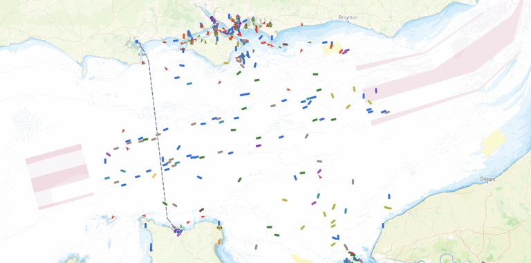
The calm before the storm—literally. Explore the synoptic charts to see what’s behind #StormAmy and when the wind and rain arrive. #MetOffice #PassagePlanning
-
What’s actually in Day Skipper Theory? Charts, tides, COLREGs, weather, APEM—and how it all clicks together. Plain-English walkthrough + ready-to-use downloads.
-
The RYA Day Skipper Theory course is where you build the bedrock of knowledge for becoming a safe, confident skipper. It’s the shore-based part of the qualification that teaches you the essential “language of the sea”—navigation, safety, weather, and the rules of the road—before you even think about taking command on the water. Your First…
-
From Overwhelmed to In Control – Stress-Free Passage Planning with APEM If you’re new to navigation and planning your first cross-Channel trip, the process can feel overwhelming. That’s where the acronym APEM comes in—Appraise, Plan, Execute, Monitor. These four steps help ensure your passage is safe, legal, and enjoyable. Let’s walk through each stage, using…
-
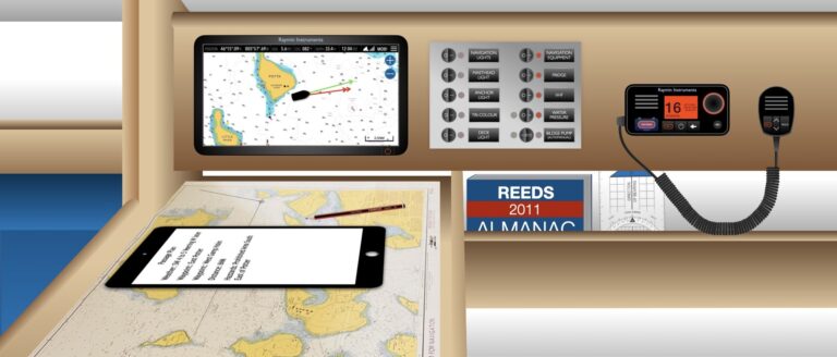
Why Verification is so Important in Marine Navigation For recreational sailors, whether seasoned skippers or weekend adventurers, the thrill of exploring the open waters comes with the responsibility of navigating safely and efficiently. While modern technology, such as GPS and electronic chart plotters, has made marine navigation more accessible and convenient than ever, relying solely…
-
The Enduring Value of Paper Charts in the Digital Age In today’s digital world, electronic nautical charts (ENCs) have become the norm for maritime navigation. With their real-time positioning, easy updates, and user-friendly interfaces, it’s easy to see why many mariners have shifted to digital solutions. As a racing skipper, I’m a huge fan of…
If you belive the Earth is flat, you're about to fall of the end...
If you belive the Earth is flat, you're about to fall of the end...